SOLVING A HISTORICAL MYSTERY

THE LONG DRAW
historical investigation photography by Lena Herzog
editor Stacey Clarkson, text by Jeremy Miller
January 2012
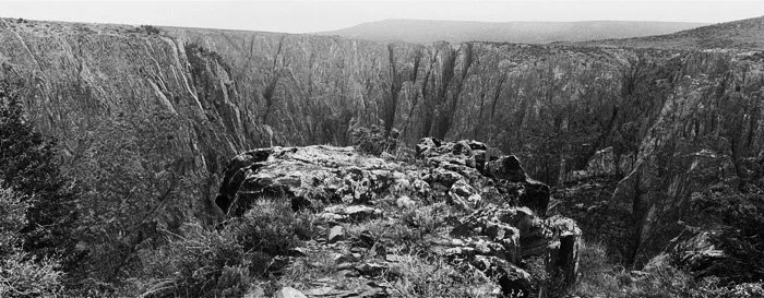
It was a century and a half ago. A labeling error brought maps and drawings made by the explorer Friedrich von Egloffstein to disrepute. Harper’s Magazine published a denunciation: Egloffstein’s maps and the drawings did not reflect the Grand Canyon’s geography. However, at the time, two canyons were called The Big Canyon: the Grand Canyon and the Black Canyon, as they are called now. A clerk at the Library of Congress filed the maps under the Grand Canyon. Writer Jeremy Miller began to suspect that the maps were, in fact of the Black Canyon in Colorado instead. Editor Stacey Clarkson, Jeremy Miller and Lena Herzog took copies of Egloffstein’s drawings and maps and set out for Colorado. 150 later, the same Harper’s Magazine restored Egloffstein’s reputation.
Editor Stacey Clarkson, writer Jeremy Miller and Lena Herzog descended down into the Black Canyon, Colorado. View from the starting point.
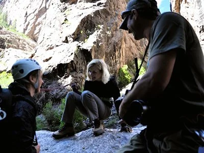
Lena Herzog and the guides at the bottom of the canyon
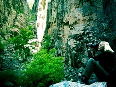
Lena Herzog at work
Editor Stacey Clarkson and the guides
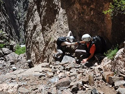
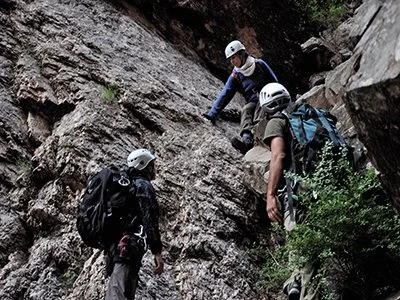
Lena Herzog and the guides climbing back out of the canyon


In 1857, Lieutenant Joseph Christmas Ives led the first American expedition into the Grand Canyon. Unlike John Wesley Powell’s famous 1869 voyage, Ives’s journey was barely publicized. Under the aegis of the Army Corps of Topographical Engineers, the party — geologists, engineers, deckhands, Yuma interpreters, natural historians, mapmakers, and artists — took a steamboat up the Colorado River to see whether it could serve as a military supply route into Utah Territory, where Mormon insurgents had killed travelers and harassed army convoys. According to historian William Goetzmann, the only throngs that saw the crew off were groups of “giggling Indians” who stood along the banks.
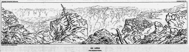
The reaction was similarly muted when Ives’s 400-page Report Upon the Colorado River of the West was finally published by Congress in 1861. The Civil War had begun, and few were clamoring for reports from the distant West. It was only decades later, after the Grand Canyon had become fixed in the public’s imagination, that the importance of the Ives report was recognized: it contained not only the first written description of the interior of the canyon but the first images of it as well, by expedition artist Friedrich von Egloffstein.
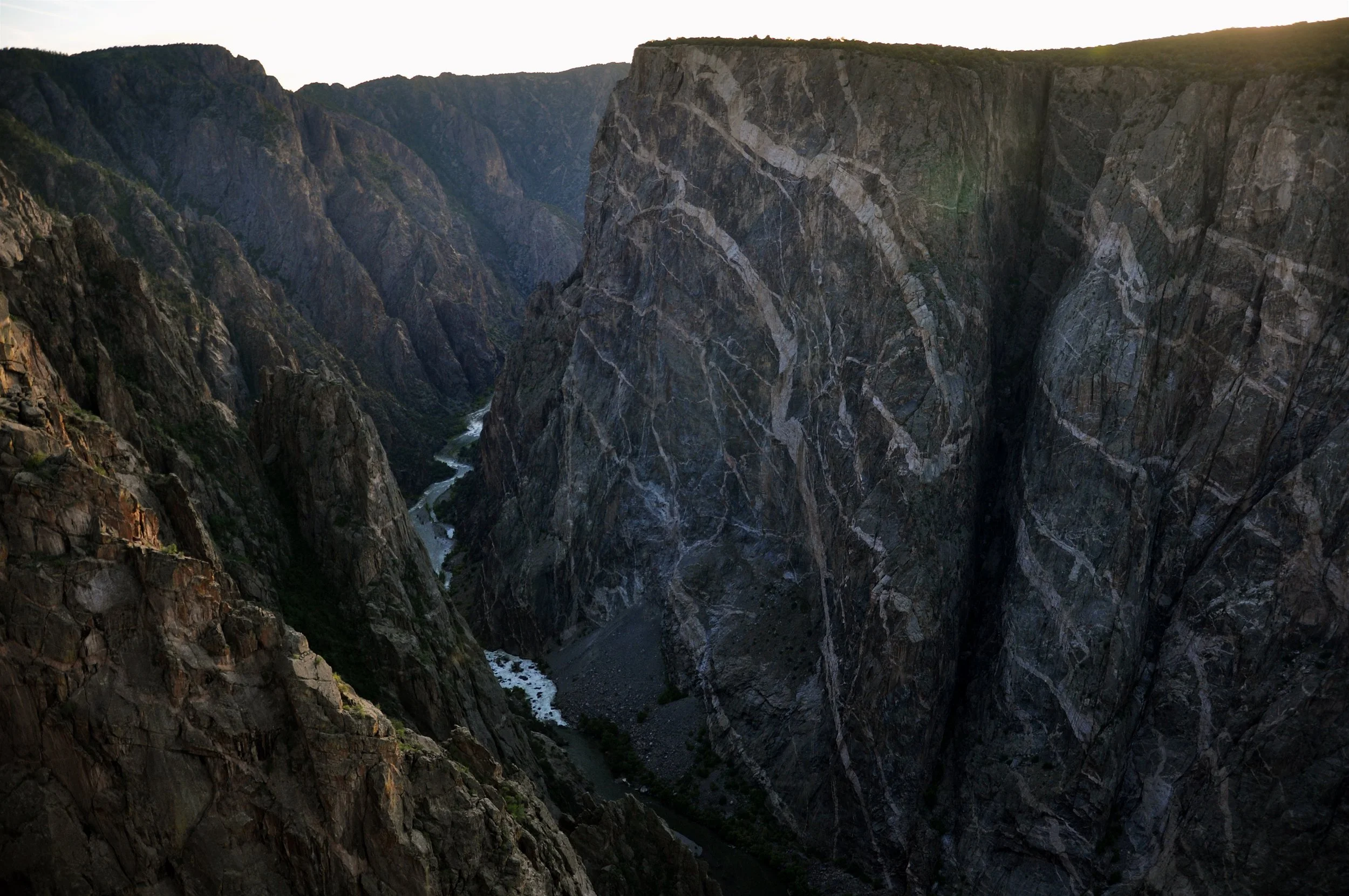
In Egloffstein’s engraving Black Cañon, said to depict the Colorado River near where the Hoover Dam stands today, the sheer black walls of the canyon appear scored into the page with a blunt, burnt stick. At the bottom of the frame, two tiny figures wrestle a rowboat from a raging, foam-white river.
It is a stunning image, but it looks nothing like the Grand Canyon. Indeed, in all of Egloffstein’s drawings of what the Ives report called the “Big Cañon” of the Colorado — three engravings and three panoramic line drawings — the landscape is unrecognizable. Instead of a sprawling gorge with distinctive strata, the images are crowded with towering spires and sharp pinnacles.
Yet Egloffstein was no incompetent: the Ives report also includes his meticulous, almost photorealistic shaded relief map of the Grand Canyon. How could he have gotten the map so right and the landscapes so wrong?